Skyway Range
Skyway Range offers a premier environment for research and testing of unmanned systems. A collaboration between Oklahoma State University, Osage LLC, and Tulsa Innovation Labs, this cutting-edge range supports specialized flight operations and system development.
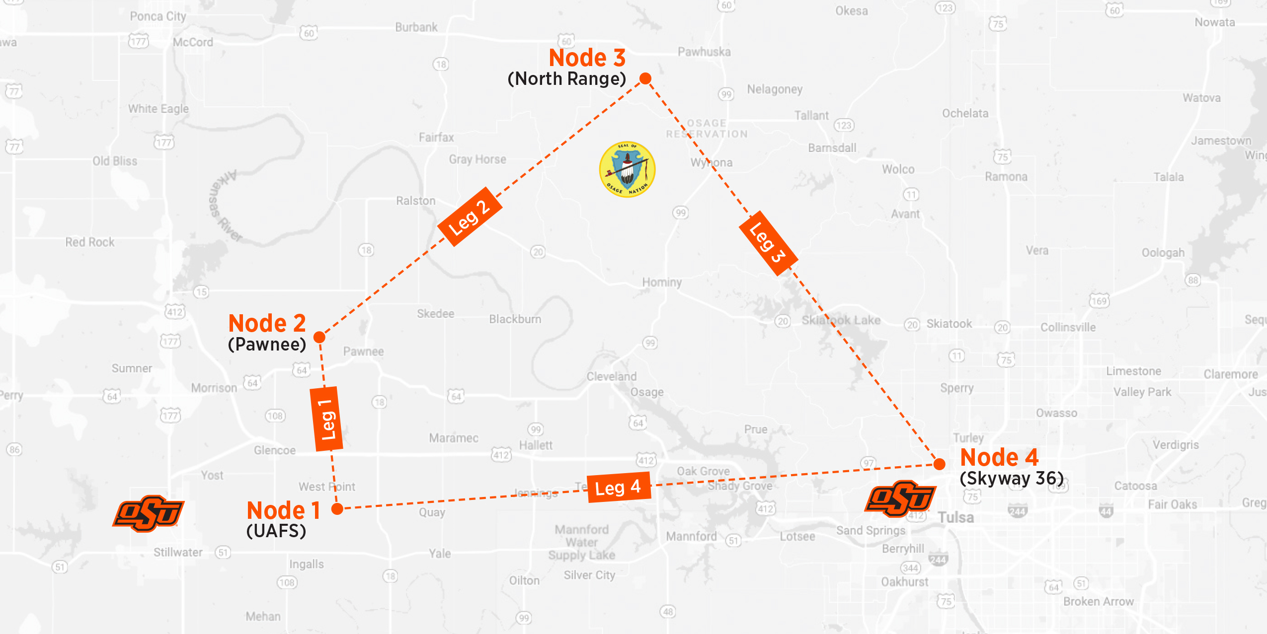
Proposed range map, which is currently under development with a 114-nautical mile circumference.
Specialized testing through waiver process with experts to assist in obtaining waivers
and flight coordination. On-site assistance with SMEs from LaunchPad for system
development ground testing, and flight.
Nodes 1, 2, and 4 are currently open for operations under Part 107 rules and Leg 1 is open for EVLOS operations with waiver coordination.
Previous flight testing within the range has included waivers for specialized uncrewed systems to over 10,000 feet AGL.
- Node 1: Unmanned Aircraft Flight Station (UAFS) with runway and hangar
- Node 2: Center for Forensic Explosives (CENFEX) with ordnance and explosives
capabilities - Node 3: North Range with low-risk airspace due to low population and Osage Nation
land ownership - Node 4: Skyway 36 Drone Port